
The Lost Lands of Mu and Lemuria
Lemuria and Mu are interchangeable names given to a lost land believed to have been located somewhere in either the southern Pacific or Indian Oceans. This ancient continent was apparently the home of an advanced and highly spiritual culture, perhaps the mother race of all mankind, but it sank beneath the waves many thousands of years ago as the result of a geological cataclysm of some kind.
The thousands of rocky islands scattered throughout the Pacific, including Easter Island, Tahiti, Hawaii and Samoa, have been claimed by some to be the only surviving remains of this once great continent. The theory of a lost continent in this area has been put forward by many different people, most notably in the mid 19th century by scientists in order to explain the unusual distribution of various animals and plants around the Indian and Pacific Oceans.
In the late 19th century occultist Madame Blavatsky reincarnated the idea of Lemuria as a lost continent / spiritual homeland and influenced a host of subsequent occultists and mystics including well known American psychic healer and Prophet Edgar Cayce. The popularisation of Lemuria / Mu as a purely physical place began in the 20th century with ex-British army officer Colonel James Churchward, and the idea still has many adherents today.
But is there any physical evidence to back up these claims of an ancient continent beneath the Pacific or Indian Ocean? Or should these ‘lost homeland’ stories be interpreted in another way entirely, perhaps as the symbol of a mythical vanished ‘Golden Age’ of man?
The Land of Mu
The idea of a lost continent known as ‘Mu’ in the Pacific Ocean does not actually have a particularly long history, neither is it mentioned specifically in any ancient mythologies as some writers have suggested. The title ‘Mu’ originated with eccentric amateur archaeologist Augustus le Plongeon (1826-1908), who was the first to make photographical records of the ruins of the archaeological site of Chichen Itza in Yucatán, Mexico. Plongeon’s credibility was badly damaged by his attempted translation of a Mayan book known as the ‘Troana Codex’ (also known as the ‘Madrid Codex’).
In his books Sacred Mysteries Among the Mayans and Quiches (1886) and Queen Moo and the Egyptian Sphinx (1896) Plongeon interpreted part of the text of the Troana Codex as revealing that the Maya of Yucatán were the ancestors of the Egyptians and many other civilisations. He also believed that an ancient continent, which he called Mu, had been destroyed by a volcanic eruption, the survivors of this cataclysm founding the Mayan civilisation. Plongeon equates Mu with Atlantis and states that a ‘Queen Moo’ originally from Atlantis, travelled to Egypt where she became known as Isis, and founded the Egyptian civilisation. However, Plongeon’s interpretation of the Mayan book is considered by experts in Mayan archaeology and history as completely erroneous, indeed much of what he interpreted as hieroglyphics turned out to be ornamental design.
Lemuria
‘Lemuria’, the alternative name for the lost continent, also originated in the nineteenth century. Ernst Heinrich Haeckel (1834-1919), a German naturalist and supporter of Darwin, proposed that a land bridge spanning the Indian Ocean separating Madagascar from India could explain the widespread distribution of lemurs, small, primitive tree-dwelling mammals found in Africa, Madagascar, India and the East Indian archipelago. More bizarrely, Haeckel also suggested that lemurs were the ancestors of the human race and that this land bridge was the “probable cradle of the human race.”
Other well-known scientists, such as the evolutionist T.H. Huxley and the naturalist Alfred Russell Wallace, had no doubt about the existence of a huge continent in the Pacific millions of years previously, which had been destroyed in a disastrous earthquake that submerged it beneath the waves, much as Atlantis was thought to have been drowned.
Before the discovery of continental drift it was not unusual in the mid to late 19th century for scientists to propose submerged land masses and land bridges to explain the distribution of the world’s flora and fauna. In 1864, the English zoologist Philip Lutley Sclater (1829-1913) gave the hypothetical continent the name ‘Lemuria’ in an article ‘The Mammals of Madagascar’ in The Quarterly Journal of Science, and since then it has stuck.
The Geologists’ View
Zoologists and geologists now explain the distribution of lemurs and other plants and animals in the area of the Pacific and Indian Oceans to be the result of plate tectonics and continental drift. The theory of plate tectonics, and it is still a theory, affirms that moving plates of the Earth’s crust supported on less rigid mantle rocks causes continental drift, volcanic and seismic activity, and the formation of mountain chains. The concept of continental drift was first proposed by German scientist Alfred Wegener in 1912, but the theory did not gain general acceptance in the scientific community for another 50 years.
With this understanding of plate tectonics geologists now regard the theory of a sunken continent beneath the Pacific as an impossibility. They also point out that theories of lost lands in the Pacific mostly originate in the 19th century, when knowledge of the area was limited and well before the Pacific sea floor had been mapped.
Blavatsky’s Lemuria
The idea of Lemuria as something more than a physical place, or at least somewhere which had been inhabited by non-human entities before the appearance of man, derives from the writings of colourful Russian occultist Helena Petrovna Blavatsky (1831-1891). Blavatsky was the co-founder, together with lawyer Henry Steel Olcott, of the Theosophical Society, in New York in 1875. The Society was an esoteric order designed to study the mystical teachings of both Christianity and Eastern religions.
In her massive tome The Secret Doctrine (1888) Blavatsky describes a history originating millions of years ago with the ‘Lords of Flame’ and goes on to discusses five ‘Root Races’ which have existed on earth, each one dying out in an earth-shattering cataclysm. The third of these Root Races she called the ‘Lemurian’, which lived a million years ago, and who were bizarre telepathic giants who kept dinosaurs as pets.
The Lemurians eventually drowned when their continent was submerged beneath the Pacific Ocean. The progeny of the Lemurians was the fourth Root Race, the human Atlanteans, who were brought down by their use of black magic, their continent of Atlantis sinking beneath the waves 850,000 years ago. Present humanity represents the Fifth Root Race.
Blavatsky envisioned her Lemuria as covering a vast area. In her own words it stretched from
...the foot of the Himalayas, which separated it from the inland sea rolling its waves over what is now Tibet, Mongolia, and the great desert of Schamo (Gobi); from Chittagong, westward to Hardwar, and eastward to Assam. From thence, it stretched South across what is known to us as Southern India, Ceylon, and Sumatra; then embracing on its way, as we go South, Madagascar on its right hand and Australia and Tasmania on its left, it ran down to within a few degrees of the Antarctic Circle; when, from Australia, an inland region on the Mother Continent in those ages, it extended far into the Pacific Ocean...
Blavatsky also describes survivors of the catastrophic destruction of Lemuria escaping to become the ancestors of some of the Aboriginal tribes of Australia. She maintained that she took all of her information regarding Lemuria from ‘The Book of Dzyan’, supposed to have been written in Atlantis and shown to her by the Indian adepts known as ‘Mahatmas’.
Madame Blavatsky never claimed to have discovered Lemuria; in fact she refers to Philip Schlater coining the name Lemuria, in her writings. It has to be said that The Secret Doctrine is an extremely difficult book, a complex mixture of Eastern and Western cosmologies, mystical ramblings and esoteric wisdom, much of it not meant to be taken literally.
Blavatsky’s is the first ‘occult’ interpretation of Lemuria, but on one level it should not be equated with the physical continent later proposed by Churchward. What Blavatsky and other occultists since have suggested concerning Lemuria could be partly interpreted as an ideal spiritual condition of the soul, a kind of spiritual-historical vision.
Nevertheless, there are some psychics and prophets who even today regard the existence of ancient Lemuria / Mu as a physical reality. Indeed, there are a few who when ‘hypnotically regressed’ have recalled former lives as citizens on the doomed continent.
Lemuria and Australia
The writings of Blavatsky and other Theosophists about Lemuria, and the idea of Australia as part of this ancient lost continent and the scene of a lost golden age, had a significant influence on mystics and occultists in the country at the end of the 19th century.
Queensland-born novelist Rosa Campbell Praed represented Australia as the last remnant of ancient Lemuria and believed the myth of the lost continent to be based on fact. In Praed’s case, she used the theosophical idea of Lemuria to present an idealised primeval history of Australia, a land very different to the Queensland frontier country wracked by racial violence she had witnessed first-hand as a child.
Other evidence for this fascination with ancient Lemuria comes in the series of Australian adventure of the 1890s known as “the Lemurian novels.” In The Last Lemurian, written in 1898 by historian of Australian exploration and adventure-romance novelist George Firth Scott, the narrator Dick Halwood discovers the remains of legendary Lemuria out in the Australian desert, in a plot involving reincarnation, pygmies, a bunyip-monster, and an occult Yellow Queen.
John David Hennessey’s An Australian Bush Track (1896) calls Lemuria ‘Zoo-Zoo land’, and locates it somewhere in northern Queensland. Its inhabitants, the Zoo-Zooans, are a “remnant of a great nation which came there from some part of the mainland of Asia,” but had lost all the arts of high civilisation they once possessed. The Lost Explorer (1890) by James Francis Hogan has Lemuria as ‘Malua’, located in the centre of Australia, and ruled by the cannibalistic Queen Mocata, the last survivor of a superior race that once lived in “the interior of the great southern continent.”
The idea that Australia was once part of this lost Eden has also influenced those of a more practical bent, and attempts have been made to locate traces of Lemurian civilisation on both the west and east coasts of Australia.
Aboriginal art, artefacts and mythology have also been used to identify the Aborigines as prehistoric remnants of the Lemurians (following Blavatsky again), who somehow escaped the devastation of 20,000 or so years ago. Indeed, in some Theosophical publications of the first quarter of the 20th century Aborigines were described as the last of the Lemurians. However, the Aborigines of Australia had already been established on the continent for at least 30,000 years at the time of the supposed destruction of Lemuria, in fact they have perhaps the longest continuous cultural history of any people on Earth, so the theory of them having a Lemurian origin does not hold water.
Colonel James Churchward
The lost civilisation of Lemuria / Mu was brought dramatically back to public attention in 1931 with the publication of Colonel James Churchward’s bizarre The Lost Continent of Mu, the first in a series of five books by Churchward about the lost continent.
In the book he claimed that the lost continent of Mu had once extended from an area north of Hawaii southwards as far as Fiji and Easter Island. According to Churchward, Mu was the original Garden of Eden and a technologically advanced civilisation which boasted 64,000,000 inhabitants. Around 12,000 years ago Mu was wiped out by an earthquake and submerged beneath the Pacific. Apparently Atlantis, a colony of Mu, was destroyed in the same way a thousand years later. All the world’s major ancient civilisations, from the Babylonians and the Persians, to the Maya and the Egyptians, were the remains of the colonies of Mu.
Churchward claimed he received this sensational information when, as a young officer in India during a famine in the 1880s, he became friendly with an Indian priest. This priest told Churchward that he and two cousins were the only survivors of a 70,000 year old esoteric order which originated on Mu itself. This order was known as the ‘Naacal Brotherhood’.
The priest showed Churchward a number of ancient tablets written by the Naacal Order in a forgotten ancient language, supposed to be the original language of mankind, which he taught the officer to read. Churchward later asserted that certain stone artefacts recovered in Mexico contained parts of the ‘Sacred Inspired Writings of Mu’, perhaps taking ideas from Augustus le Plongeon and his use of the Troana Codex to provide evidence for the existence of Mu.
Unfortunately, Churchward never produced any evidence to back up his exotic claims, he never published translations of the enigmatic Naacal tablets, and his books, though they still have many followers today, are perhaps better read as entertainment than factual studies of Lemuria / Mu.
Nan Madol
It was James Churchward who first posited the theory that the site of Nan Modal, on Pohnpei Island in the North Pacific Ocean, was one of the seven cities of ancient Mu / Lemuria.
The cyclopean ruins of Nan Modal, at one time a ceremonial centre covering 11 square miles, consist of around 90 small artificial islands built up out of a lagoon, and interlinked by a network of tidal canals. These islands, situated on the tidal flats southeast of Temwen Island, Micronesia, contain house foundations, sea walls – thirty feet tall in places, tunnels and burial vaults, all constructed entirely from prismatic basalt columns stacked crisscross like log cabins. These rocks weigh several tons on average, with the largest weighing 25 tons.
What makes the construction all the more remarkable is that the stone had to be transported some distance to the site, as no quarries have been found nearby, though they do exist elsewhere on the island. A clue to how this feat was achieved are crystal basalt columns discovered at the bottom of the lagoon near Temwen Island and on the shores of other islets in the area, which would suggest that the stones were transported by raft.
Modern Pohnpeians, on the other hand, believe the stones were flown over the island using black magic. Radio carbon dates and analysis of pottery from Nan Madol reveal that construction of the site began around 1200 CE, though the area may have been occupied from as early as 200 BCE. Such dates would certainly preclude any connection with Churchward’s Lemurians or their descendents.
At the beginning of the 13th century CE the island of Pohnpei is thought to have been conquered and unified by the mysterious ‘saudeleur’ dynasty, and it was then that the spectacular complex was constructed as a ceremonial and political seat for the new royal line. The saudeleur line was brought to an end in the 1500s by exiled Pohnpeian warrior, Isokelekel. The new chiefs, known as Nahnmwarki, occupied Nan Madol for a couple of hundred years, but by the 1800’s when the first Europeans arrived, the site was deserted. Why this happened remains one of the many mysteries of this incredible site.
The Kerguelen Continent
In the last twenty or so years submerged civilisations have once again been in the news due in particular to a number of intriguing underwater discoveries. In 1999 the Joint Oceanographic Institutions for Deep Earth Sampling (JOIDES) Resolution research vessel made an amazing discovery drilling in an area of the southern Indian Ocean about 3,000 km to the southwest of Australia.
The researchers discovered that an underwater plateau about a third the size of Australia, known as the Kerguelen Plateau, was actually the remains of a lost continent, which sank beneath the waves around 20 million years ago. The team found fragments of wood, a seed, spores and pollen, in 90 million year old sediment, as well as types of rocks associated with explosive volcanism.
One of the many fascinating points about the Kerguelen Plateau is that it contains sedimentary rocks similar to those found in India and Australia, which indicates that they were at one time connected. Scientists believe that around 50 million years ago, the continent may have had tropical flora and fauna, including small dinosaurs. With further research planned, the fascinating puzzle of the Kerguelen Plateau may yet resurrect the Lemuria debate.
Yonaguni Island and the Gulf of Cambay
In 1985 off the southern coast of Yonaguni Island, the westernmost island of Japan, a Japanese dive tour operator discovered a previously unknown stepped pyramidal edifice. Shortly afterwards, Professor Masaki Kimura, a marine geologist at Ryukyu University in Okinawa, confirmed the existence of the 183m wide, 27m high structure.
This rectangular stone ziggurat, part of a complex of underwater stone structures in the area which resemble ramps, steps and terraces, is thought to date from somewhere between 3,000 to 8,000 years ago. Some researchers have suggested these ruins are the remains of a submerged civilisation – and that the structures represent perhaps the oldest architecture in the world. Connections with Lemuria and Atlantis have also been mentioned.
However, some geologists, such as Robert Schoch of Boston University, and others with knowledge of the area, insist that the underwater ‘buildings’ are natural, mainly the result of ocean erosion and coral reef settlements and similar to other known geological formations in the region. Furthermore, archaeologists also point out that no man-made tools or weapons have been recovered from the site, which would indicate human settlement.
In December 2000 a team from the National Institute of Ocean Technology (NIOT) claimed to have discovered the remains of a huge lost city 36 metres underwater in the Gulf of Cambay, off the western coast of India. A year later further acoustic imaging surveys were undertaken and evidence recorded for apparent human settlement at the site, which included the foundations of huge structures, pottery, sections of walls, beads, pieces of sculpture and human bone. One of the wooden finds supposedly from the city has given a radiocarbon date of 7500 BCE, which would make the site 4,000 years earlier than the oldest known civilisation in India.
Research is ongoing at this fascinating site, now known as the Gulf of Khambat Cultural Complex (GKCC), which if the dates are proved correct, may one day radically alter our understanding of the world’s first civilisations. However, it must be added that a number of marine geologists believe that the NIOT scientists have made serious errors in their interpretations of the sonar images obtained from the area.
The opinion of these researchers is that the supposedly ancient ‘ruins’, shown as geometric patterns on the images, are natural rock formations and there is no evidence that the artefacts discovered in the area of the site, including the radio-carbon dated block of wood, are associated with it. The debate is still continuing among geologists, archaeologists and historians on this controversial discovery.
Whether any of these underwater finds in the Pacific and Indian Oceans prove to be the remains of forgotten civilisations or not, one thing is certain – man will always be searching for a lost homeland or a more spiritually satisfying ancient past. In this sense Lemuria or Mu will always be more than just a physical place.
http://www.newdawnmagazine.com/Article/The...nd_Lemuria.html
While neither Atlantis nor Lemuria were continents in a strict geological sense, both were indeed “continental”
in their far-flung influences and vast cultural extent. The Pacific civilization was variously known as “Lemuria” and “Mu.” Both names appear interchangeably throughout world-mythic traditions, but any differences in significance between them are not understood. Refugees from Mu took few of their records with them while making their escape to the nearest habitable dry land. Cayce tells us that Lemurians of the brown race were the first of the great horde of strangers to reach Peru. James Churchward, who first popularized the subject in his series of books about Mu in the 1920s, wrote that the aristocracy of Lemuria was ruled by a white race.
Indeed, Polynesian legends still speak of white-skinned, fair-haired culture-heroes who fled to the Pacific islands after their homeland sank into the sea. California’s Chumash displayed many Caucasian characteristics, such as full beards, not shared with other Indians. Moreover, these native tribes of white people told of their ancestral arrival from an island that went down into the sea and even named one of their sacred, off-shore islands “Limu.” It also appears that a black population was in residence at Mu, descendants of which migrated westward into Micronesia, where they became today’s Negritos. Other black Lemurians journeyed to the Americas, where they participated in Mexico’s Olmec Civilization, and became memorialized through the great stone heads sculpted by its ancient artisans.
The brown race of which Edgar Cayce spoke appears to have been Lemuria’s native majority population,
whose descendants comprise modern Polynesians, despite significant influences from Asia and India. Churchward, who published decades before the Cayce material was generally known, likewise stated that a brown race resided in Mu. Cayce divulged the following information in response to a question concerning the appearance of the Earth’s surface during the zenith of Atlantean greatness.
Cayce tells us the Lemurians were unlike the aggressively imperialistic Atlanteans and may have been reluctant to assert themselves in foreign lands. Their self-imposed isolation could have been part of Mu’s cultural personality, much like the introverted feudal Japanese up until the mid-19th century.
Excerpts from Atlantis Rising magazine #23
While Atlantis get's its fair share of publicity, the more ancient Lemuria unfortunately does not get as much attention as it should. Lemuria was a very advanced civilization in the Pacific Ocean. Map with its most relevant whereabouts visible in underwater topography.
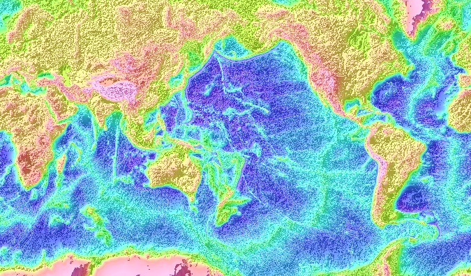
This is a topographical map showing both the above-sea level ground and the sunken ground in the Pacific area. The mainland of the civilization is now underwater because of the extremely turbulent plate tectonics that occur in that area, which is also called the Ring of Fire, because of the thousands of volcanoes there.
A great book that ties in many fascinating archeological discoveries that can be traced to this tens-of-thousands year-old civilization is The Lost Civilization of Lemuria by Frank Joseph
Available here: http://www.amazon.com/Lost-Civilization-Le...1065&sr=8-2
he primary aspect I like in Joseph's book is that he, unlike most individuals, does not believe that Lemuria was some super continent, as some sketches show. There is no proof of this in the topography of the Pacific Ocean. He agrees with geologists in ruling out an actual continental landmass, but makes a good case for an archipelago spanning the Pacific, for which there is more than enough evidence for. The largest islands are now submerged, however, and they were larger than the landmass of Atlantis, if Atlantis was truly where the Azores islands are today, which is almost certain given the archeological, topographical, and ancient mystery schools' evidence.
The main argument I have pertaining to Joseph's work is that he emphasized the caucasian complexion of the Lemurians. However, the evidence points to the contrary. Atlanteans were fair-skinned (white) and Lemurians were dark-skinned (Golden Brown and Black).
Besides this point, much of the information is phenomenal and the hard evidence that he compiled together in one book is phenomenal. As this topic continues, I will continue to add evidence and information concerning Lemuria and it's vast and peaceful civilization...a civilization that was quite different from Atlantis in many many ways.
Nan Madol
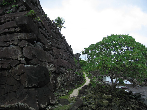
It is positioned roughly half way between Hawaii and the Philipines, at the location where severe storms and typhoons are generated when cold air is brought into contact with the warm waters of the Caroline Islands - many severe storms originate from Nan Madol's location. This is no coincidence. Because severe storms originate there, it is very rarely hit by these storms, making it the safest location in the pacific. Now the major effect which contribute to typhoons and hurricanes is electromagnetic energy - NOT water temperature (see Joseph Newman's work below), temperature is important, obviously, but is secondary.
Joseph Newman's findings
Nan Madol and Kosrae (a similar structure to Nan Madol also located in the Federated States of Micronesia) create a 300-mile-long zone in which typhoons are born and the first stages of their power and severity are developed. The storms soon grow much larger and wind up ravishing the Philippines. Until recently, they were thought to be the exclusive result of masses of cold air convectored into conflict with water’s warmer temperatures. Mainstream meteorologists believe cyclones are produced during a three-step process by the initial intensity of the storm, temperature changes in the air it brings about, and subsequent heat exchange with the ocean. However, late in last century, Joseph Newman declared that:
The major effect in respect to hurricanes is electromagnetic. For a hurricane to remain a hurricane, it does not depend solely on the heat of the water over which it travels.
Proof: The average temperature of the waters of the Gulf of Mexico, 20 miles of the Louisiana coast, is as follows:
July, 82 degrees F
August, 87 degrees F
September, 82 degrees F
October, 76 degrees F
November, 66 degrees F
If what the weather experts said were true, the greatest number and most destructive hurricanes would always occur in July and August, not true! Fact: The peak hurricane season is only in September – not July or August. September and October have 300 per cent more hurricanes of greater destruction than July or August, even November has 80 per cent as many hurricanes as July and August.
Therefore, Newman deduced that temperature was of secondary importance in the production of hurricanes, adding that electromagnetism was the most important factor.
Platinum and silver 'bars' were found within Nan Madol.
WHAT POWERS IT?
Pohnpei, the island attached to Nan Madol, has unique and constant subtle siesmic activity. Seismic activity generates piezoelectricity. The piezoelectricity works with the strangely magnetized basalt to focus a concentrated coronal discharge skyward.
Now considering the location of Nan Madol, the unique and intentionally altered magnetism of the basalt and the layout of the ruin, it can easily be argued that Nan Madol was ancient weather manipulation technology used to diffuse dangerous storms before they can build up. The coronal discharge let off by the magentized basalt, which is generated by piezoelectricity sourced by the island's constant subtle siesmic activity, means that Nan Madol could react with a storm's electromagnetic elements and effectively diffuse the storm.
Situated in the Caroline Islands in the South Pacific, Nan Madol is a collection of about 100 ancient artificial islands connected by artificial canals built of megaton basalt blocks in order to act as a weather modification project built to prevent tropical storms from becoming typhoons. This was accomplished by quarrying basalt, from a yet-unknown location), magnetizing it with a very peculiar magnetism, and generating power by having hundreds or thousands of electric eels in the canals, each yielding about 650 volts (if I remember correctly). These artificial islets were built at the birthplace of typhoons in the Pacific ocean and this power station would essentially breakdown any new typhoons that would have formed, and make them release their energy in the form of downpours. Platinum coffins were placed on the bottom of the islets in order to work as some sort of device that would keep the weather modification station from overloading with energy. According to the ancient stories, these lincoln-log looking basalt stones (which are upwards of 60 tons were moved by two powerful magicians in a few days. There is a scientific explanation for this, which deals with magnetizing the basalt, making it featherweight, and levitating it into position, but that is a longer discussion for another time. There are still eels in the canals to this day.
There is absolutely no evidence that Nan Madol was were a city. There are no remains of any kind, minus a few burnt electric eeels, which most probably resulted when there were electrical shortcircuits from time to time.
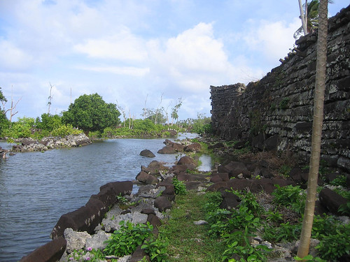
The location is at least 12,000 years old. The reason for this is that much of the structures are up to 100 feet below sea level. The last time the sea was 100 feet lower was around the last Ice Age in 10,000 BC. Off the coast of Nan Madol is a sunken "city" called Kahnihmw Namkhet. A book that discusses this submerged island, along with other ancient Lemurian locations is Lost Cities of Ancient Lemuria & the Pacific, which you can read for free here:
: http://books.google.com/books?id=FD3Vsw8Jn...mTRBg&hl=en
The pictures in this post are from Nan Dowas island, in Nan Madol.
More pictures here: http://mpwarner.smugmug.com/gallery/230232...144887648_RUcrx
Area view of the islands: http://wikimapia.org/7824656/pl/Nan-Dowas
There was a documentary film created in 1982 entitled Ponape: Island of Mystery, a very rare film since it was shown on Australian television only once.
Lemuria
An ancient civilization of the Pacific predating both the emergence and destruction
of Atlantis. The name derives from a Roman festival, celebrated every
May 9, 11, and 15, to appease the souls of men and women who perished when
Lemuria was destroyed by a natural catastrophe. These dates probably represent
the days during which the destruction took place. The Lemuria festival was believed
to have been instituted by the founder of Rome, Romulus, as expiation for the
murder of his twin brother, Remus. During the observance, celebrants walked barefoot,
as though they had fled from a disaster, and went through their homes casting
black beans behind them nine times in a ritual of rebirth; black beans were symbolic
of human souls which were still earthbound (that is, ghosts), while 9 was a sacred
numeral signifying birth (the nine months of pregnancy).
The ritual’s objective was to honor and exorcise any unhappy spirits which
may haunt a house. This part of the Roman Lemuria is identically observed by
Japanese participants in the Bon Festival, or “Feast of Lanterns,” when the head
of the household walks barefoot through each room of his home exclaiming, “Bad
spirits, out! Good spirits, in!” while casting beans behind him.
Obviously, both ancient Rome and Japan received a common tradition independently
from the same source, when Mu was destroyed in a great flood. A graphic
reenactment of that deluge occurred on the third day of the Roman Lemuria, when
celebrants cast 30 images made of rushes into the River Tiber. What the images
represented (perhaps human beings?), and why they were put together from rushes
is not precisely known, but they were plainly meant to simulate loss in a torrent of
water. Nor is the specific significance of 30 understood, although Koziminsky (citing
Heydon’s similar opinion) defines it as appropriately calamitous (49).
The name, “Lemuria,” is not confined to Rome, but occurs as far away as
among the Chumash Indians of southern California. They referred to San Miguel
Island, site of an un-Indian megalithic wall, as “Lemu.” Laamu is in the Maldives,
south of the Indian subcontinent at the equator, featuring the largest hawitta, or
stone mound, in the islands, constructed by a foreign, red-haired, seafaring people
during prehistory. Throughout Polynesia, Lemu is the god of the dead, who reigns
over a city of beautiful palaces at the bottom of the sea. On the Polynesian island
of Tonga, Lihamui is the name of the same month, May, just when the Roman
Lemuria was celebrated.
In some of these names, “l” and “r” become interchangeable. The Roman
festival may also have been called “Remuria,” just as Polynesia’s god of the dead
was sometimes prayed to as “Remu.” Lima, the Peruvian capital, was preferred
by the Spanish conquerors over the native “Remu,” which was probably itself a
linguistic twist, like the others, on the name of a pre-Inca city, originally known as
“Lemu.” If so, it represents another Lemurian influence on coastal Peru. “Lemuria”
is a variant of “Mu,” which, according to Churchward, means “mother.” “Lemuria,”
then, may have been an equivalent of “motherland.”
Today the names of Lemuria and Mu are used interchangeably for the lost continent in the Pacific described by Mayan texts and the Indian bible. Lemuria was known as Rux Uleu and Lemulia to the Mayas. In both the Codex Troanus (Troano Codex) and the Codex Cortesianus, the Maya recorded the sinking of this land.
The legends of Easter Island speak of Hiva, which sank beneath the waves as people fled, while one of the Samoan legends call a similar place Poluto. The Maoris of New Zealand still talk about arriving long ago from a sinking island called Hawaiki, a vast and mountainous place on the other side of the water.
The myths and traditions of India abound with references. The Rig Veda speaks of "the three continents that were"; the third was home to a race called the Danavas. A land called Rutas was an immense continent far to the east of India and home to a race of sun-worshippers. But Rutas was torn asunder by a volcanic upheaval and sent to the ocean depths. Fragments remained as Indonesia and the Pacific islands, and a few survivors reached India, where they became the elite Brahman caste.
Hopi Legend - On the bottom of the seas lie all the proud cities, the flying patuwvotas [shields] and the worldly treasures corrupted with evil. Faced with disaster, some people hid inside the earth while others escaped by crossing the ocean on reed rafts, using the islands as stepping-stones.
The same story of escape to dry land appears in the Popol Vuh - the Mayan story of creation. Augustus Le Plongeon, (1826-1908) a 19th century researcher and writer who conducted investigations of the Maya ruins in the Yucatan. He announced that he had translated ancient Mayan writings, which allegedly showed that the Maya of Yucatan were older than the later civilizations of Atlantis and Egypt, and additionally told the story of an even older continent of Mu, whose survivors founded the Maya civilization. Later students of the Ancient Maya writings argue that Le Plongeon's "translations" were based on little more than his vivid imagination.
http://www.bibliotecapleyades.net/atlantid...ria_video01.htm
Stone monuments of mysterious origin dot the entire Pacific, from Japan's underwater site at Yonaguni, to cryptic Petroglyphs on Hawaii's Big Island, to Easter Island among sacred and megalithic sites.
The Rosircucian Theory
A disastrous cycle began with volcanic eruptions, earthquakes, and the collapse of subterranean gas belts. Magnetic waves moved around the globe and Lemuria sank into the sea. Some colonists reached India and from there Mesopotamia and Egypt while others migrated eastward on crude rafts to the Americas, forming the racial core of the earliest Indian tribes. California was home to history's oldest people: pure Lemurians who later became the California Indians. That could explain why some America's oldest human artifacts were found on Santa Rosa Island off Santa Barbara, dating around 25,000 B.C.
Small groups of Lemurians salvaged part of Lemuria's wisdom, storing the information in Lemurian Seed Crystals which contain the knowledge and story of Lemuria. Later the crystals would be discovered, their messages decoded, when the time would come for anther civilization to return to the sea. This is that time.
Pictures of Lemurian crystals: http://www.celestialights.com/Lemurian_See...d_crystals.html
Lemuria. like other mythological civilizations, and religious ideologies, are part of humanity's quest to remember that we are not physical beings searching for our spiritual selves, but spiritual being having a physical experience that moved from higher to lower frequency of thought consciousness and is now about to return. Life, all life, is about the movement of consciousness in the alchemy of time.
Reality is Myth, Math and and Metaphor - Magic and Mirrors - stories created in 'time' for the experiencer projected through the eye or lens of the camera into the matrix to be perceived consciously as if virtual reality. ALL is projected illusion in the Alchemy of Time and Consciousness - ALL are parallel running programs through which we consciously experience simultaneously.
Programs have inserts. If a civilization is an insert in a grid program that could explain why fully evolved civilizations suddenly spring up out of nowhere, the 'sea of creation', the flow of the collective unconsciousnes or the consciousness grid that creates realities. If time is an illusion - all programs are running simultaneously. Therefore you are experiencing many civilizations at the same time. This often explains the feeling of deja vu or why some souls are drawn to live in a specific region and feel at home there.
Sumer is an example of a programmed insert that sprang out of nowhere as an advanced civilization, then disappeared.
There are those who believe that Lemuria suddenly appeared with a full-blown culture. This has spawned many interesting theories, including visits from extraterrestrials who introduced a new species of genetically engineered humans to replace their slow-witted ancestors. This too links with other creational theories about humans being seeded by gods or aliens.
Most of what is written is a metaphor linking to the patterns of creation and sacred geometry. It is about spiraling consciousness that moves from higher frequencies of thought, a higher harmonic, to slower/lower frequencies as we experiencing many places at the same time. All realities are created based on the numeric blueprint of sacred geometry, consciousness, the Golden Mean, or the Phi Ratio.
http://www.crystalinks.com/lemuria.html
A wealth of information concerning the wood tablet writings of Easter Island that originated in Lemuria: http://www.chauvet-translation.com/talking.htm
Rongorongo
Even orthodox researchers have to admit that the Easter Island script – Rongorongo – constitutes a genuine enigma. Rongorongo now survives only as markings on 25 pieces of wood scattered around the world’s museums, though other tablets might still be hidden in the island’s sacred family caves. Some signs also survive on paper in makeshift ‘books’ from the late 19th and early 20th centuries. The glyphs contain about 120 basic elements – human figures in a variety of positions, birds, animals, plants, celestial objects, and geometrical shapes – but these are combined to form between 1500 and 2000 compound signs. Many of the motifs are also found in the island’s rock art, but none are found on any statues or platforms.
In the 1930s Guillaume de Hevesy identified similarities between the rongorongo signs and 130 signs used in the at least 4500-year-old script found in the towns of Mohenjo-Daro and Harappa in the Indus Valley. The Indus Valley script was usually written from right to left, but there are a few early cases of boustrophedon. (Some Etruscan and Hittite texts are also written in boustrophedon style, as are some Greek ones from about the 6th century BC.)
The seals used in the Indus Valley were made of soapstone. It is noteworthy that one Easter Island legend says: ‘The first race invented the Rongo-Rongo writing: they wrote it on stone. Of the four parts of the world that were at one time inhabited by the first race, it is only in Asia that this writing still exists.’5 Interestingly, Mohenjo Daro and Easter Island lie almost exactly 180° apart: the former is situated at 27°23'N and about 69°E and the latter at 27°08'S and 109°23'W.
Other writers have pointed to resemblances between rongorongo signs and about 40 archaic Chinese ideographs, mostly dating from before the 8th century BC. Jean-Michel Schwartz asserts that there are resemblances not only in the form of the characters, but also in their meanings.7
Rongorongo is often said to be the first script to be found in Oceania. However, in 1913 John Macmillan Brown found a script of some 60 characters on Woleai Atoll in the Caroline Islands (fig. 7.4).8 Whereas the Easter Island script is largely ideographic, the Woleai script was syllabic, but unlike any other in the world. It was used by the young chief of the island and was known only to five people on it, though it was also in use on Faraulep, a small island about 160 km to the northeast. In 1908 an expedition to Faraulep collected a number of symbols forming part of a counting system. The numbers ranged from 100,000 to 60 million and would have had no use in daily life. It seems unlikely that the Woleai script originated on a small isolated island.
Much more information, as well as several pictures of Lemurian architecture: http://ourworld.compuserve.com/homepages/dp5/easter3.htm
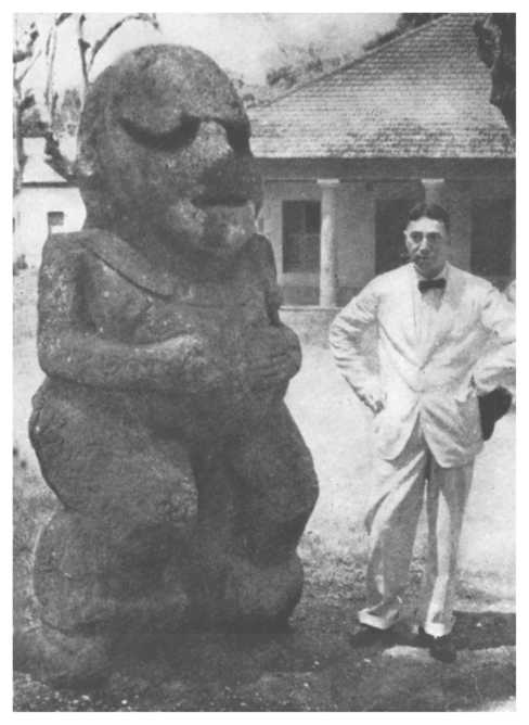
Easter Island's maui (the statues) served as, according to The Lost Civilization of Lemuria, reverse-energy antennas or the geological equivalent of lightning rods, conducting and transmuting dangerous terrestrial forces into the atmosphere. It was a sort of anti-earthquake device. It is at the intersection of two major fault lines in the Pacific Ocean and thanks to the crystalline materials (basalt) in the maois, they transferred the mechanical energy of earthquakes into electical energy. It can be noted that this is a similar type of use as the structure at Nan Madol was, which was a weather-modification station used to break down typhoons.
I don't remember what they were called, but this is a sketch picture of a beautiful girl from one of the ancient human ethnic groups that was killed off by Christian missionaries several hundred years ago. Such a beautiful race of people who, I believe, were descendants of the Lemurians, were driven to extinction by their own human race. It saddens me...Christianism is the greatest plague earth has ever had.

The Isle of Pines
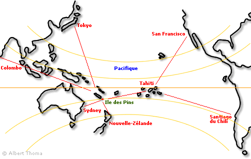
The Isle of Pines is an island located in the Pacific Ocean, in the archipelago of New Caledonia.
The Isle of Pines, also called Kunie, is an interesting place, since it has pine trees that are native to the island, whereas the thousands of other islands do not have pine trees. This is the only island where ancient pine trees (Araucaria cookii) thrive and grow. When discovered in 1774 the scientific world was baffled. These trees grew to 135 feet tall.
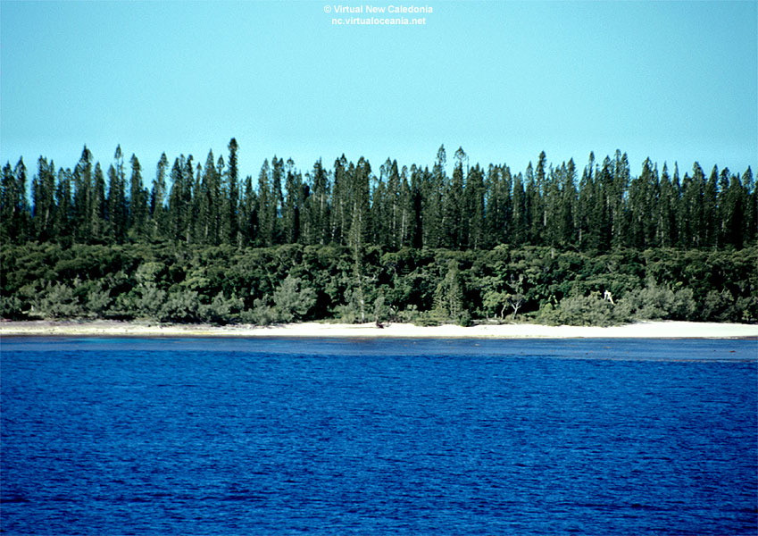
There are more than a hundred puzzling mounds, tumuli, on the iron plateau near the airport. Their heights are 2 to about 15 feet.
Cement cylinders (columns) have been found under these man-made mounds. The larger tumuli enclose a block of tuff, about 5 feet high and 6 feet in diameter, comprised of tumuli material held together by a calcareous cement or mortar.
Radiocarbon dating has these cylinders at 13,000 years old at the most, but unquestionably in the range of 5120 BC-10950 BC. Even the lowest date being some 3,000 years earlier than man is believed to have reached the southwest Pacific from the area of Indonesia.
High iron content has been found in the cement cylinders.
There are hundreds of these mounds that were not burial chambers, as there were no bones found under the mounds. There were no bones, no artifacts, symbols, and in fact, no drawing on inscriptions at all. This points to an industrial use, as seem on Nan Madol, which also had none of the above-mentioned items.
http://www.articlesbase.com/mysticism-arti...nes-491027.html
http://www.isle-of-pines.com/history.html
http://www.science-frontiers.com/sf043/sf043p01.htm
http://books.google.com/books?id=FD3Vsw8Jn...BQKg0&hl=en
Tonga
Tonga has a 109 or 12 ton gate (depending on who you talk to) or arch made of coral with the dimensions being 15ft x 18ft. It's apparent function was as a solar calender, with much similarity to the one in Tiahuanaco in the Andes Mountains. It is called the "Burden of Maui" or in the Tongan language, Ha'amonga 'a Maui
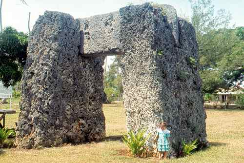
The pyramids of Tonga, called langi, were built to be earthquake-resistent.
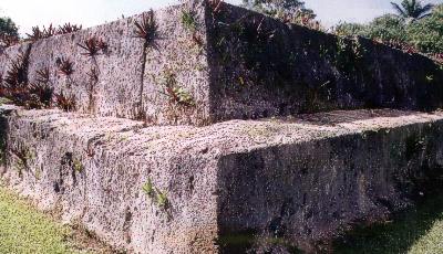
It is said in the local legends that the Mu'a built these. This word translate into literally the "men from Mu". A clearer connection to Mu and Lemuria could not be made linguistically.
http://en.wikipedia.org/wiki/Ha%27amonga_%27a_Maui
Mariana Islands
The Mariana Islands, which include Guam, have peculiar megaliths called lat'te stones, or latde stones. Latte stones have been made of limestone, basalt or sandstone. The word latde translates into "houses of the old people", or more specifically, they were also called Taotao Mona, which translates into "spirits of the Before-Time People" or "the people before history". Latte stones varied greatly in size. The smallest were several feet tall. The largest latte still standing is 16 feet (5m) tall, located in Tinian. In Rota, quarried latte would have stood 25 feet (8m) high if erected. The largest shaft found here weighs 34 tons while the largest cap weighs 22 tons.
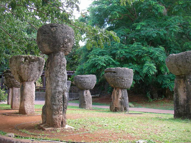
http://en.wikipedia.org/wiki/Latte_stone
http://en.wikipedia.org/wiki/Taotao_Mona
http://guam.org.gu/hemplo/taotaomo.html
Palau
The island of Babeldaob in Palau is 153 square miles, 5% of which was terraformed into food-producing terraces, enough to feed hundreds of thousands of people.
There are also stone statues which are infused with quartz to produce peizoelectricity, made from andesite.
New Guinea
There is an 8ft high obelisk surrounded by smaller standing stones.
New Ireland
On New Ireland, which is part of Papua New Guinea, there is a stonehenge-like formation with illustrations carved on them. It is located on Mt. Kambu 2,500ft up. It is so ancient that the natives do not even have legends about them.
Tahiti
The Atakura Temple resides in Tahiti and is an ancient pyramid that was unfortuantely dismantled in the mid 19th century on orders of Christian missionaries because they were said to have been built before the Great Flood. In the great temple at Atahura the stone structure was 270 ft. long, 94 ft. wide, and 50 ft. high, and its summit was reached by a flight of steps built of hewn coral and basalt.
http://www.1911encyclopedia.org/Tahiti

New Zealand
The Kaimanawa Wall was probably part of a step pyramid. It was built by the Wai-ta-hanui, New Zealand's oldest tribe that predates the Maoris. There are only 140 mixed descendants left. Their ancestors were known as the Moriori, Wai-ta-hanui, or Urukeku, which translates into "the people of the west". I would like to take this moment to specify that the picture of the girl that was a Lemurian descendent was one of the people of the Moriori tribe and no, this race of people was not wiped out by christian missionaries, but they were enslaved by Maoris and then were cannibalistically eaten by them. First came enslavement, then genocide, then cannibalistic feasts. Truly, a sad story. It's is a good thing I was able to find out where that girl was from, since it changes things quite a bit. These people lived by a code of non-violence and passive resistance, which led to their near-extinction at the hands of Māori invaders.

The stones that make up the wall are 4-ton blocks of ignimbrite, a soft volcanic rock that could have been easily dressed with stone tools. The wall is topped by a red beech tree 2.9 meters in circumference and over a meter of accumulated humus. "There was no doubt that the stones had been cut. The four visible stones in the front wall were a uniform 1.6 metres tall, and 1 metre wide. In one place he could insert his arm into a root-ridden cavity and feel the back face -- and the front face of the next tier. The faces were uncannily smooth, with no saw or adze marks. The interstices where the blocks join were knife-blade thin.
"Further up the hill, the tops of other stones protruded, suggesting a more extensive structure was buried in the hill."
Supporting the contention that a pre-Maori people lived in New Zealand are the bones of the kiore, a type of rat alien to New Zealand, which was likely introduced by the first settlers. Some kiore bones have been dated as 2,000 years old -- centuries before the first Maoris arrived.
http://www.mysteriousnewzealand.co.nz/phot...ils.php?album=5
http://www.science-frontiers.com/sf107/sf107p00.htm
Society Islands
Raivavae is 400 miles from the Society Islands, it's nearest neihbor. There are monumental statues and stone walls that are megalithic that have been discovered.
The Menehune
Also known as Nawao.
Menehune are the 'little people' of Hawaii, similar to pixies or trolls.
The folklore of many nations around the world include stories of magical little people. The most famous of course, are the leprechauns of Ireland. In Hawaii, it is the mischievous Menehune who are said to haunt the deep forests or the mountains of Pu'ukapele ("Hills of Pele"). They come out mostly at night to play tricks on people, or to serve them if they feel that way inclined.
The mythology of the Menehune is as old as the beginnings of Polynesian history. Some say that the great god Maui himself, was one of the tiny creatures. When the first Polynesians arrived in Hawaii, they found dams, fish-ponds, and even Heiaus (temples), all presumably built by the Menehune who were already there, living in caves.
The creatures are said to be about two feet high, although some have been seen as small as six inches, capable of fitting in the palm of someone's hand. They are always naked, but the long straight hair that falls to their knees keeps them warm and discreet. Apparently no two of them are the same, and they can be so moody as to be malicious and dangerous one day, and simply harmless the next. But they are always tricky, and therefore should be avoided, unless a special favor is absolutely needed of them.
In the old times, some Hawaiians married Menehune girls, who were said to be quite fair, but needed to be shown how to make a fire and eat cooked food, because their own diet consisted only of starchy raw vegetables. The services of Menehune expert builders and craftsmen can be requested. This is especially so, if you can trace your family tree back to one of them. They then act like benevolent godparents. Many a major project, such as the preparation of a wedding feast, has been completed in a single night by the super strong little gods, while all humans slept.
Menehune are afraid of owls. On the island of Kauai, the Menehune sometimes sneak in among the people there and pull too many tricks. That is when the owl god of Paupueo (owl hill) summons all the owls of Kauai to chase the Menehune back into the forest.
The little ones are fond of dancing, and singing, and of sports, such as shooting arrows. Sometimes they use magic arrows, to pierce the heart of angry persons, and make them feel love instead. They also truly enjoy diving off cliffs into the surf. If you hear splashes in the night at Kaanapali, it is possibly a Menehune diving off Black Rock! But you would have to move impossibly quick to ever see one.
http://www.pantheon.org/articles/m/menehune.html
From Wikipedia:
In Hawaiian mythology, the Menehune [pronounced meh-neh-HOO-neh] are said to be a people, sometimes described as dwarfs in size, who live in the deep forests and hidden valleys of the Hawaiian islands, far from the eyes of normal humans. Their favorite food is the mai'a (banana), but they also like fish.
The Menehune were said to be superb craftspeople. Legends say that the Menehune built temples (heiau), fishponds, roads, canoes, and houses. They are said to have lived in Hawaiʻi before the human settlers arrived many centuries ago.
In Beckwith's Hawaiian Mythology, there are references to several other forest dwelling races: the Nawao, who were large-sized wild hunters descended from Lua-nu'u, the mu people (as in Mu and Lemuria), and the wa people (Beckwith 1970:321-323).
Some early scholars theorized that there was a first settlement of Hawai'i, by settlers from the Marquesas Islands, and a second, from Tahiti. The Tahitian settlers oppressed the "commoners", the manahune in the Tahitian language, who fled to the mountains and were called Menahune. Proponents of this theory point to an 1820 census of Kauaʻi by Kamualiʻi, its ruling chief of that island, which listed 65 people as menehune (Schmitt 1981).
Folklorist Katherine Luomala believes that the legends of the Menehune are a post-European contact mythology created by adaptation of the term manahune (which by the time of the settling of the Hawaiian Islands had acquired a meaning of "lowly people") to European legends of brownies (Luomala 1951). Menehune are not mentioned in pre-contact mythology; the legendary "overnight" creation of the Alekoko fishpond, for example, finds its equivalent in the legend (Nordhoff 1874) about the creation of a corresponding structure on Oʻahu, which was supposedly indeed completed in a single day - not by menehune, but, as a show of power, by a local aliʻi who demanded every one of his subjects to appear at the construction site and assist in building.
Wainiha Valley, the place where the Menehune once lived
© 2025 Created by Tara.
Powered by
![]()